
A cold front moving out of the northeastern United States continues to develop rain, drizzle, and fog for parts of the Maritimes through Thursday morning.
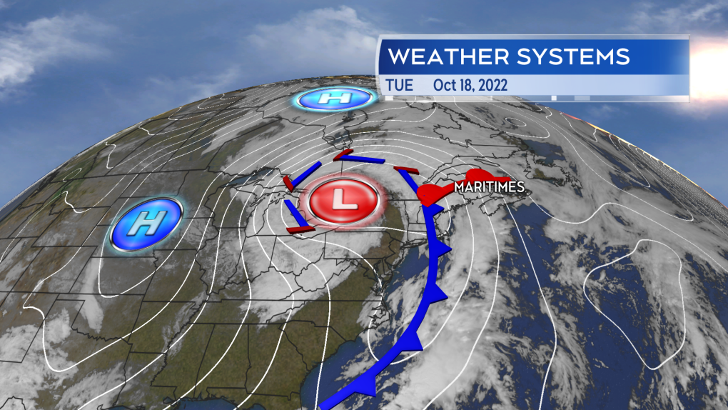 A weather front is building towards the Maritimes bringing rain, drizzle, and fog along with it.
New Brunswick is already into intermittent rain and the western half of Nova Scotia is seeing scattered showers with a risk of small thunderstorms. There's also a chance of showers for Prince Edward Island through Wednesday.
The steadiest wet weather remains in western parts of the region Tuesday night. Wednesday morning will see rain, heavy at times, in western New Brunswick and southwestern Nova Scotia. Wednesday afternoon and evening, the rain shifts eastward into P.E.I. and eastern mainland Nova Scotia. Wednesday night into Thursday morning the rain moves into Cape Breton where it will clear Thursday afternoon.
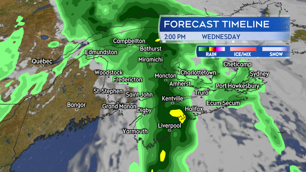 Most of the wet weather will be for New Brunswick and western Nova Scotia through Wednesday morning. The rain shifts eastward Wednesday afternoon and night.
The most total rain is expected in western New Brunswick where rainfall warnings and special weather statements have been issued. The areas under rainfall warnings are cautioned to expect totals of 40 to 90 millimetres. The special weather statements are calling for totals of 30 to 60 millimetres. Digby, Yarmouth, and Shelburne counties in Nova Scotia have also been placed under a rainfall warning. That warning advising that totals of 50+ millimetres are possible in heavy downpours. The higher totals increasing the risk of localized flooding and hydroplaning conditions.
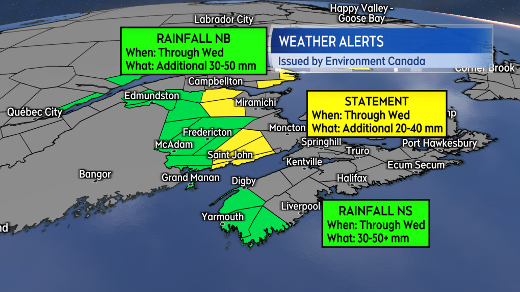 Rainfall and special weather statements are in effect for western New Brunswick and southwestern Nova Scotia.
Most of Nova Scotia can expect a general 20 to 40 millimetres of rain. Eastern New Brunswick, P.E.I., and parts of northern Nova Scotia, as well as the Annapolis Valley, may finish a bit lower, with 10 to 25 millimetres.
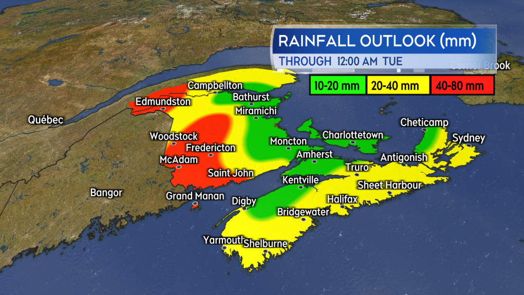 A general 10 to 40 mm of rain for the Maritimes with higher totals in western New Brunswick.
Gusty south and southeast winds will accompany the rain Tuesday into Wednesday. The gusts will peak 30 to 60 kilometres per hour for most. Exposed areas of the coastline could hit a higher range of 60 to 80 kilometres per hour for brief periods. The wind turns westerly region wide Wednesday night. The wind on Thursday out of the west and southwest is forecast to have gusts of 20 to 50 kilometres per hour.
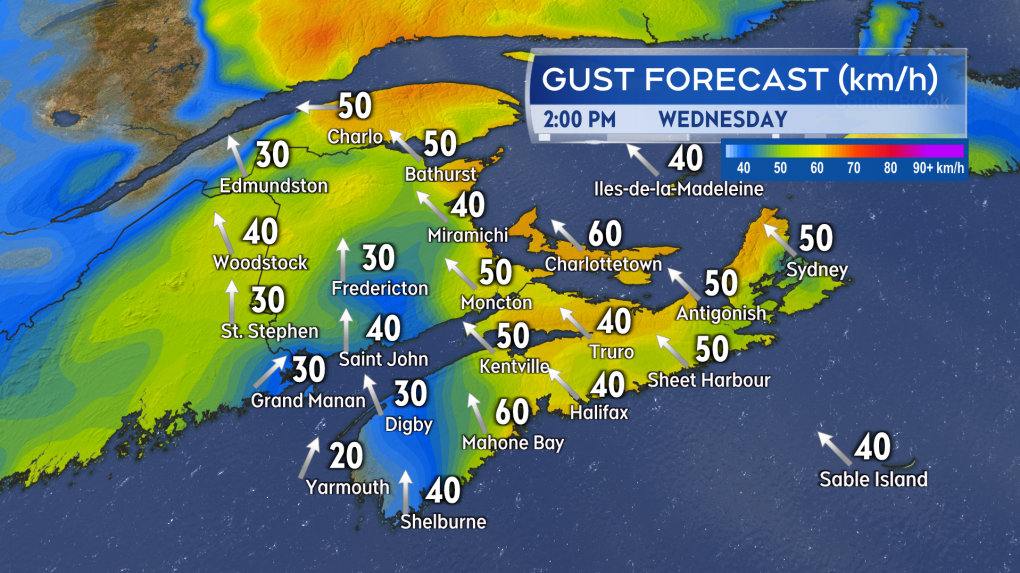 Gusty southeasterly winds will accompany the wet weather into Wednesday. Wind turns westerly for Thursday with peak gusts diminishing.
High pressure builds in Friday through the weekend with generally fair October weather forecast through that period.
Post a Comment