
It’s Friday and there’s a good chance that you’ll order dinner in. If you’re like myself and my fiancé, the ordering process can be frustrating. You go over several options, taking in all the information, and then go back and forth on a decision several times before just making a grilled cheese sandwich and going to bed.
The forecast for the upcoming snow acted the same way this week. Now we sit with the grilled cheese snow-wich, and hope it was the right choice to satisfy us.
Preambles aside, it has been a very back and forth week on trying to nail down the timing and amount of snowfall coming to Vancouver Island at the end of this weekend and through the bulk of next week.
Here’s what we know for sure: A blast of cold Siberian air will take over Western Canada and many parts of the Southern States. This is the coldest air on the planet, with Siberia hitting -61 C at one point last week.
Thankfully, it won’t be that cold, but we’ll get our share of chill next week. As we sit in the cold, any moisture introduced to the area will be in the snow category more than any other moisture category.
The picture below shows that by next Friday we’ll push the cold air out and return to more seasonal temperatures, along with rain.
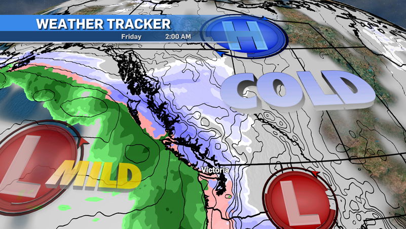 A weather model looking forwards to Friday, Dec. 23, is shown. (CTV News)As I write this article, the models are still arguing about timing and amounts. Here’s how I see it playing out, and remember these numbers are subject to change, especially the mid-week ones.
The cold air will really take over Sunday night into Monday. We have a system moving in and snow will start Sunday evening rolling through Monday morning and a good portion of the afternoon.
Greater Victoria can expect five centimetres into the morning hours and another three to five centimetres during the day. Daytime highs on Monday will keep below 0 C through most island regions and will stay there until Wednesday or Thursday.
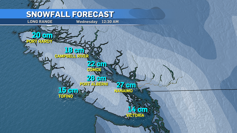 A long range weather model is shown, though exact snowfall totals are subject to change. (CTV News)
North of Greater Victoria in the Mid and North Island, the usual snow-laden areas will see more snowfall, but again there’s a lot of arguing going on with the models.
As of Friday, no special weather statements, watches or warnings have been issued for Vancouver Island. I expect that to change into the weekend for the island.
Tuesday and Wednesday could be another troublesome timeframe but we’ll have to take a "wait and see" approach. This really is a day-by-day, if not hour-by-hour, process to forecast.
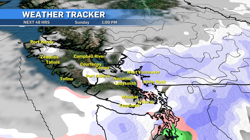 A weekend weather model is shown. (CTV News)
With all the factors going into the forecast, it’s truly a boom or bust scenario for the Pacific Northwest. Some snow lovers will be disappointed, non-lovers may get what they want with small totals and minimal impact.
Prepare for Monday morning snow for now and then after that check in for the rest of the week and what it could bring. Also have yourself a nice grilled cheese sandwich, it’s comfort food during a small blast of winter.
Post a Comment